


Update 22.1.4
Data Wizard updated for MNemo v2.
Better management of large explorer/surveyor teams.
Time stamped backup of projects created before over writing file.
Filtering capabilities improved.
IGRF-13 model systematic use for declination calculation.
Various minor bug fixes.
Update of framework to Microsoft JDK 17.0.4
Update 21.1.1
Linked video in 3D Panel
New data categories in the section description
Update 19.2.8
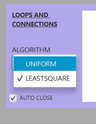
Least square loop closure mode
A new loop closure mode that uses least square optimization methods has been added to the Loop Panel. Highly recommended for complex loops scenario.
GPU CUDA Support
For the loop closures, the software will use when ever possible the GPU of the graphic card to make the calculations faster.

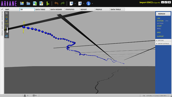
Seacraft ENC2 import support
The track generated by Seacraft's ENC2 navigational console can now be imported into Ariane.
Other New Features
A new display mode has been added to the 2D map to show the direction in which the survey has been done.
In complex profile the control points can now be dragged with the mouse and the tension controlled with the wheel.
The User Interface has been changed to allow a proper display on smaller screens.
The project uses now Amazon Corretto 11 LTS as framework on all 3 supported platforms.
BUG
Profile tensions were not properly taken in account for 3D display.
BUG
Corrected bug where a section was not removed from the filter table when data was not filtered and stations removed.
Update 19.1.9
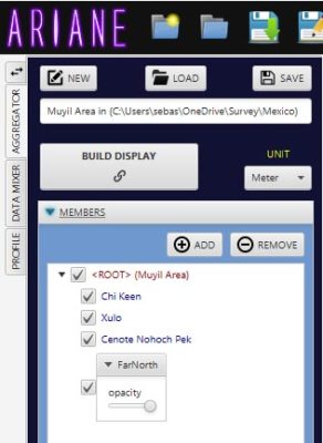
Aggregator capability
It is now possible to aggregate your various projects, add customized satellite overlays and other KML paths.
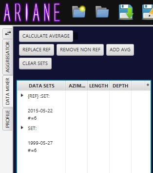
Averaging Resurvey Data
A new Data Mixer panel has been added. You can now average the resurvey you do with the original data.
Smooth 3D cave modeling
The 3D volume of the cave can now be precisely modeled thanks to full NURBS definition of the profiles
Other New Features
The coordinates of the mouse get displayed while it moves on the map.
A new file format TMLU has been introduced. It is an uncompressed abbreviated XML file that can be used in GIT systems.
An export option has been added to the 3D map. The KML export can now include the 3D walls.
A GIF export function has been added allowing the creation of animated GIF showing the progress in exploration over time.
The number of satellite images being downloaded is displayed in the lower status bar of the main window.
The distance between the mouse cursor and a selected station gets displayed automatically.
Data can be "Excluded", in this case it won't be taken in account in statistics nor map redrawing but still be saved in the file.
A lot of optimization in background to speed up redraw and loop calculation on multi core hardware.
Update 4.2.2018.15
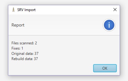
Walls (SRV and WPJ) Import
SRV and WPJ files generated for Walls can be opened directly in Ariane. Those file formats support a lot of different options. Only the most common have been implemented for the moment. If you need different formats let us know!
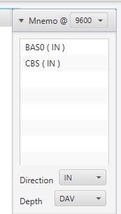
MNemo Import changed
All the import options ( Direction and depth variation type) have been added to the import window of MNemo.
Big Data
An accelerated display and calculation mode ( Big Data) has been added to optimize display and manipulation of big files ( >5000 stations)
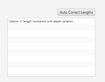
Auto Correct incoherent data
When imported data has incoherent length/depth variation an autocorrection feature has been added.
BUGS
The license information could get lost on Mac OSX.
Update 4.2.2018.11
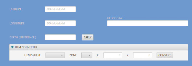
UTM Conversion tool
A UTM conversion tool has been added to the DataWizard
Anonymize Tool
A tool to make your file anonymous ( removing comments,dates and names) has been added in Data Tools
BUGS
Showing/Hiding Cartography display Layer was not working
When relinking two stations, inconsistent scenario could crash the app.
Update 4.2.2018.8
Update
The software has been moved to the latest version of Oracle Java (v10.0.1)
BUGS
Undo in cartography was flattening layers for Overlays.
The export of Compass DAT was erroneous on Mac OS X
When data was filtered and didn't contain a START the profile would not be displayed correctly
Update 4.2.2018.6
KML Export
The wall if defined gets exported in the KML file.
3D View
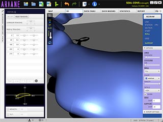
A horizontal plan as well as a dropped shadow can be activated to make the 3D display of the cave more readable.
Data Wizard
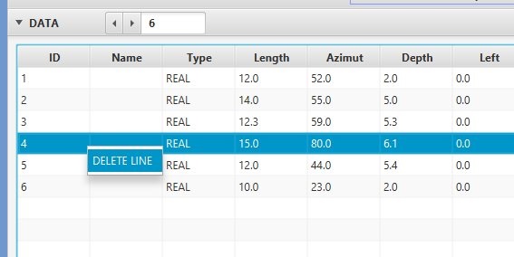
In the Data Wizard the user has the possibility to right click a Data line and remove it from the table. This is particularly useful for MNemo import with markers or faulty shots.
What's new Panel
When the software is updated a panel with the info about the modification is displayed. It can be hidden by clicking on the close button next to the Tab Title.
BUGS
Profile calculation was erroneous for certain end of lines.
When a survey with MNemo was interrupted because battery was empty, the software could not import the data nor any following it.